ELAINE HALL
Assistant Resource Manager
From lazy rivers that are deep, wide, slow and flat, to white water and small streams that are shallow, narrow, fast and rigid — not all waterways are created equal.
In stream ecology we call all these combined differences in a river its morphology. River morphology is a combination of influences that makes that river stretch look and move the way it does. Factors such as discharge (how much water is being moved), water surface slope (is it running down a mountain slope or moving through the flat plains), water velocity (how fast is the water moving), depth, width, and what the river bottom is made out of (mud to boulders).
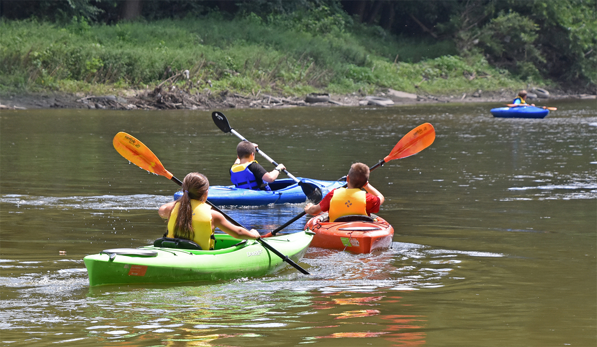
Whether you’re paddling, fishing, or hiking the banks of a river, finding out information about the stretch of river you are looking to visit can greatly impact your recreational experience. Several different rivers flow through our parks. At one end of the spectrum the Scioto River at Scioto Audubon Metro Park is impounded by the Green Lawn Dam creating a reservoir of wide deep water. Due to the dam this area of the river rises with stormwater and flooding waters, but through the hot dry summer months retains navigable waters.
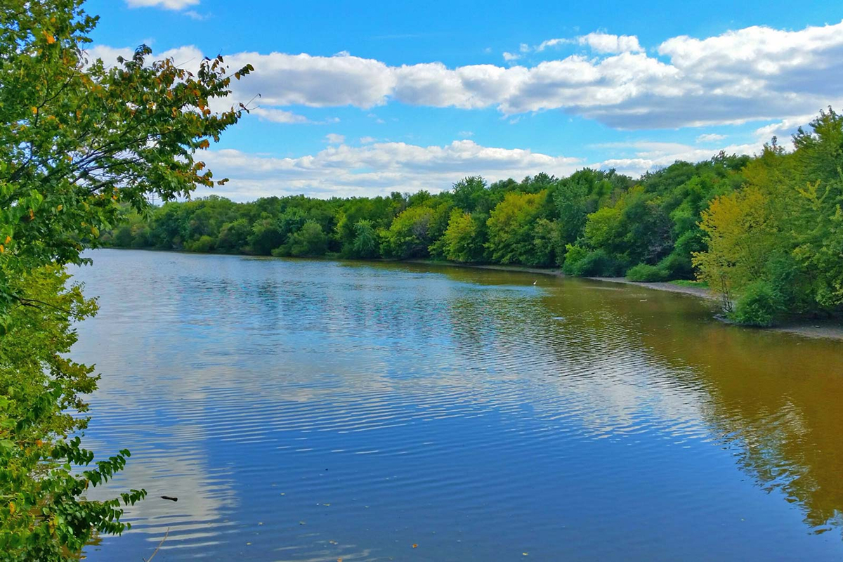
On the opposite end of the spectrum, smaller streams in a watershed rise and fall quickly and generally have shallow rocky and narrow waterways. Big Darby Creek that runs through both Prairie Oaks and Battelle Darby Creek Metro Parks is an example of this. It rises and floods quickly and dangerously during snowmelt and spring rain, but dries to levels that do not allow paddling in summer and fall.

Many local streams that have (USGS) gauges in them that collect information that you can utilize to ensure that water conditions are ideal before you even leave home. Often called “Know Before You Go” applies to safety information you can check to help you stay safe and informed.
Here is a water condition that applies to all water safety:
TEMPERATURE — The National Center for Cold Water Safety recommends treating any water below 70°F with caution. Water temps below 60°F can be immediately life threatening due to “cold shock.” This is when you lose breathing control, your heart and blood pressure are affected, and your ability to think clearly is impaired.
The best way to see what local water temperatures may be at different gauges then those that monitor water levels. For example, the water chemistry of Darby Creek can be checked on the USGS monitoring location above Georgesville, OH (395339083130100).
Being mindful of how recently the last rainfall was and the time of year greatly influences water parameters that you must be considerate of, especially water levels. Remember that not all waterways are the same.
WATER LEVELS — Current water level conditions, read in feet (stream height) and/or cubic feet per second,cfs (streamflow), can be checked on many different outdoor and paddle apps or websites, all of which use the USGS gauge data. https://waterdata.usgs.gov/state/ohio/
Here is a little information about a couple of the waterways in our park district. These are the levels we use to inform the public on the safe water levels that we’ve monitored at our parks over the years. But if you ever have questions, reach out to the rangers at the parks.
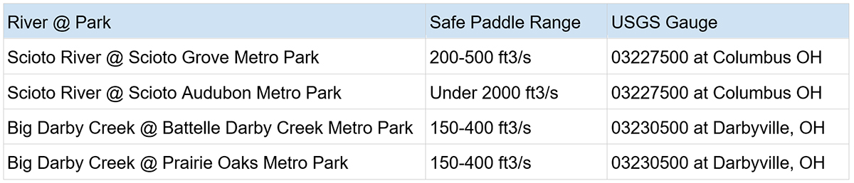
Some parks even have signage posted about water levels at their launches. What’s the best water level to paddle Big Darby Creek?
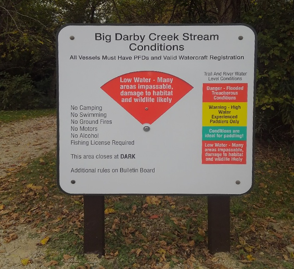
Above 800 cfs – Danger! — Flooded Treacherous Conditions, No Launching from Canoe Access
800-400 cfs – Warning — High Water, Experienced Paddlers Only!
400-150 cfs – Optimal — Conditions are ideal for paddling.
Below 150 – Low Water — Water is too low, NO LAUNCHING from Canoe Access many areas impassable, damage to habitat and wildlife likely.
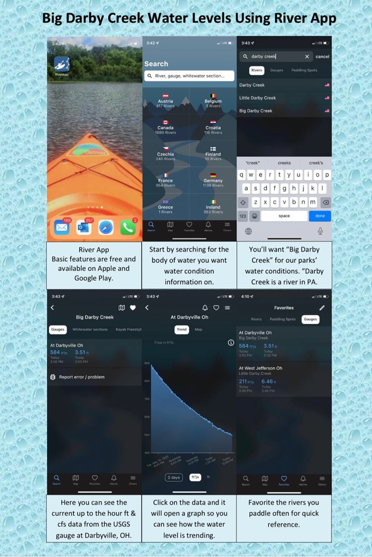
Pro Tip: Pictured below is one of our park naturalists favorite free apps to stay up to date on water levels. “Between hosting programs like creeking nearly daily during the late spring through fall, and getting calls from paddlers about current water conditions this app has really come in handy. It uses the same data from the USGS gauges, but it has a super easy to read interface and you can set favorite gauges for quick reference.”
Also remember to have your boat registered, always wear a lifejacket, and no swimming in the parks.
Happy Paddling!